
Search a Mineola Street by Address
For a named Mineola street, begin with the address rather than a person’s name. The county’s public tools center on parcels. They can establish the street spelling, town, ZIP, Parcel ID, and Nassau Section, Block, Lot, often shortened to SBL. Those details make later searches more reliable. They also prevent an address in a Mineola postal area from being confused with an address inside the incorporated village.
- Enter the house number when known, the street name, and ZIP in the Nassau AROW property search. Save the exact street spelling, Parcel ID, town, and SBL returned.
- Open the same location in the Nassau Land Records Viewer. Record its village, town, school and local-district context, assessment dates, tax information, and visible sales context.
- Use the SBL and legal description to check the Nassau Clerk land-record index. Capture each party role, recorded date, document number or book and page, and the instrument type.
- If current registration information is needed for a known person, use the New York voter lookup with its required identity fields. It is not an all-residents-on-a-street search.
- For a building timeline, request the defined permit, certificate-of-occupancy, inspection, or code file from the Village by address, SBL, date range, and record type. Old address clues can then be taken to local history holdings.
Each source answers a narrower question. An owner shown in a deed may be an estate, trust, or entity. A permit can name an owner or applicant. Neither result proves who occupies every unit or room on the property.
Mineola Street Directory Field Rules
AROW accepts an address or SBL search. The inspected public screen marks Street and ZIP as required for the street route. Nassau’s instructions say to use the street name only, omit directional words and suffixes, and try a partial street prefix when needed. Its result list shows a Parcel ID, number, street address, town, and ZIP. The public screen did not expose an owner-name search, so an address-to-SBL approach is the supported starting point.
| Portal field | Where used | How to enter it | Why it matters |
|---|---|---|---|
| House Number | AROW | Numeric when known | Narrows a street query. |
| Street | AROW | Required; omit direction and suffix | Use a partial prefix if a full name fails. |
| ZIP | AROW | Required with street | Confirms the postal portion of an address. |
| Section, Block, Lot | AROW and LRV | Use as the alternate parcel route | Links the address to title records. |
| House Number and Street | LRV | Address lookup; omit direction and suffix | Opens parcel and map context. |
| Town and ZIP | LRV | Use with the address fields | Separates postal naming from parcel geography. |
That small record trail matters in Mineola because the village crosses the Towns of North Hempstead and Hempstead. The current assessment-roll files are separated by town and often by school district. A postal line alone is not enough to choose the correct roll.
Convert a Mineola Address to SBL
A Nassau SBL is the legal parcel key: Section, Block, and Lot. The Land Records Viewer’s sample Mineola parcel showed Section 9, Block 411, Lot 516, while its stable result URL encoded the same identification. Keep the three pieces as shown. The county cautions that the Assessor and Clerk databases may use different SBL placeholders, so the Clerk record controls for official land-record work.
Use the SBL before treating a similar street name as the same property. AROW and LRV can supply the address and parcel context; the Clerk index can connect recorded parties and instruments to the legal description. A street directory search becomes stronger when the street, SBL, town, and document details all agree.
- Parcel
- A defined piece of land in the county assessment system, identified in Nassau by an SBL.
- Situs address
- The physical location of the building or land. It can differ from an owner’s mailing address.
- Legal description
- The land description used in title documents. It is more durable than a postal label.
- Criss-cross directory
- A reverse directory arranged by address, used to look for a historical occupant after the correct address is known.
Owner mailing address, situs address, and legal SBL serve different uses. The captured LRV parcel did not show an owner name or mailing address. A property card or defined county request is the appropriate next route when an official field is needed.
Mineola Parcel Maps by Street
The Land Records Viewer combines the assessment roll with parcel, tax-map, district, tax, exemption, comparable-sale, and linked GIS information. It is parcel centered. Search with SBL or house number, street, town, and ZIP, then use the map and parcel context to inspect a location. A CAPTCHA may apply, and the site says an account can bypass that challenge.
The viewer is useful for sorting a road record from a municipal record. Mineola’s plan identifies Jericho Turnpike and Hillside Avenue as east-west corridors, with Old Country Road at the south. Herricks Road, Mineola Boulevard, Willis Avenue, and Roslyn Road run north and south. The Village’s road-maintenance information also distinguishes state and county roads. That assignment does not prove a village boundary or a resident’s address.
Note: Map context helps verify the parcel, but the inspected materials did not confirm a public whole-street export or a named radius tool.
Mineola Street Directory Record Coverage
Address-keyed records can be combined without treating any one of them as a complete roster. The table separates what each Mineola street directory source can add from what it cannot establish. Start with the parcel, then use title and village records for the specific question at hand.
| Address record | Custodian | Street evidence | Access and limit |
|---|---|---|---|
| AROW result | Nassau Assessment | Parcel ID, address, town, ZIP | Free address or SBL search; owner-name mode not confirmed. |
| LRV parcel view | Nassau GIS and Assessment | SBL, districts, values, taxes, sales, appeals | Public viewer; CAPTCHA may apply; owner mailing field was not visible in the captured sample. |
| Assessment card or roll | Nassau Assessment | Assessed-property details and exemptions | County office and card-request route; current public field release should be confirmed. |
| Deed and mortgage index | Nassau County Clerk | Recorded parties, dates, document references | Free index; images and copies have charges; older access can require terminals or requests. |
| Permit or C/O file | Mineola Building Department | Owner or applicant, SBL, work, and inspection chronology | Request by defined address and date range; no inspected online history index. |
| Voter record | Nassau BOE and NYS | Registration information for an identified voter | Lookup requires identity fields; protected records are excluded. |
For historic occupants, ask the Mineola Memorial Library or Historical Society whether a reverse or criss-cross run exists for the needed year. No complete Mineola shelf list or exact reverse-directory run was confirmed in the research, so a specific title and year request is safer than assuming a volume is available.
Recorded Owners Along Mineola Streets
The Nassau Clerk calls its land index the official index of real-property ownership. Its Deeds/Mortgages search offers name, document, book, section, reference, and recorded-date modes. For an address trail, use the SBL and legal description first, then preserve the grantor and grantee roles exactly. A grantor transfers an interest; a grantee receives it. The next older transaction is tested against the same lot, map references, adjacent parcels, and date.
The online portal displayed a certified index range beginning March 30, 1992 during inspection. Its image notice says images are available from February 22, 1994 forward, with older records added periodically. County historical material reports deed, mortgage, and map archives back to 1899 and an electronic database beginning in 1992. For an older instrument that does not appear online, use Clerk public terminals or the Map Room, ask staff about deed books and grantor-grantee indexes, or submit a defined written request.
Index searching is free. Portal notices list paid image downloads and printed search results, while certified copies come from the Clerk. The Clerk’s current operating procedures describe in-person, mail, delivery, lobby drop-box, and e-recording routes for land-record requests. They are separate access channels, not interchangeable evidence.
Mineola Permit Files by Address
Village building material ties proposed work to an address, SBL, zoning details, and owner or applicant information. A defined permit request can help date an addition, demolition, certificate of occupancy, plumbing or electrical work, fence, pool, and inspections. The research did not locate a public live permit-history index, so describe the address, SBL, date range, permit type, permit number if known, and the requested C/O or inspection record.
The Mineola Building Department provides the local permit and board context shown in the following office view.
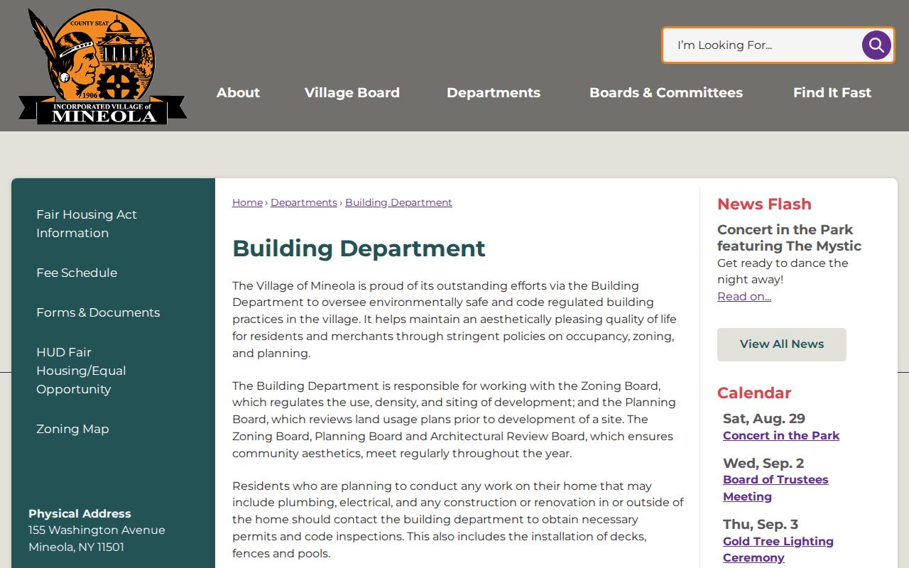
A permit file can describe work at a Mineola address, but it should not be used as a substitute for a deed or as proof of every current occupant.
Building applications distinguish the property address from an owner or applicant address. That distinction is valuable when comparing papers, yet it also means a name on a form may reflect a project role rather than residence.
Mineola Street Directory Voter Limits
New York’s voter lookup is designed for a registered voter who supplies last name, first name, date of birth, county, ZIP code, and address information. It is not a map or a public street-wide list. Registration records are public for supervised inspection under Election Law §3-220, but driver-license and non-driver ID numbers, Social Security numbers, facsimile numbers, and confidential-voter information are excluded.
A defined Nassau Board of Elections FOIL or data-processing request may be appropriate when the legally releasable fields and geography are clear. Ask for the current form, fee, format, active or inactive status handling, and protected-record suppression. Protected registrations under Election Law §5-508 are kept separate from public inspection and copying.
That restraint is important. A person lookup, a parcel owner, and an actual household are separate record questions. Do not turn a partial registration record into a claim about everyone along a Mineola street.
Mineola Street and Postal Boundaries
Mineola is Nassau County’s seat, but its records geography has two common traps. The incorporated village lies mostly in North Hempstead with a slim southern portion in Hempstead. Also, county offices can use a Mineola, New York 11501 mailing address while their physical campus is in adjoining Garden City. Record the parcel town and SBL along with the street and postal label.
When an older directory and a current portal disagree, do not assume a renumbering or renamed street. No official Mineola street-renumbering or street-renaming year was located. Compare the SBL or legal description, adjacent parcels, the 1917 Sanborn street labels, deeds, and road-maintenance lists instead. Historical street work belongs with local-history sources, while the modern street-by-street chain remains address keyed.
Limits of a Mineola Street Directory
A Mineola street directory cannot reveal a complete household. Non-owner occupants, utility customers, delivery records, and protected voters do not become a public street roster. DMV personal information is restricted under the federal Driver’s Privacy Protection Act. A property record may identify a parcel owner or mailing contact, but that does not show that the person lives at the situs.
For former occupants, the historical directory collections can supply a separate, dated clue. The Mineola city directories path is the place to pursue those volumes rather than treating a current parcel screen as a history of everyone who lived there.